Map of abruzzi italy and Travel Guide

The Abruzzo area is bounded to the north by the Marche region, to the west and southwest by Lazio, to the southeast by Molise, and to the east by the Adriatic Sea. There are three national parks, natural reserves, and protected areas within a third of the 10,795 square kilometers in the region. With the Gran Sasso, Europe’s southernmost glacier and a 130-mile stretch of coastline all inside its borders, Italy has a lot to offer.
Detailed Map of the Abruzzi
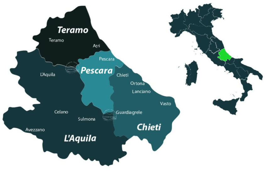
See the region’s location within Italy as well as its key cities and villages on this comprehensive Abruzzo travel map.
Cities in Abruzzo
This map above shows the various provinces and also the main 4 cities of the Abruzzo region: Teramo, L’Aquila, Pescara and Chieti.
Municipalities and Towns
There are 305 municipalities in our four provinces. To let you understand, Municipalities are Italy’s territorial entities, in Italian called ‘comuni’ and you will find the whole list on Wikipedia.
Inside each municipalities there are ‘frazioni’, districts or small villages, and the list is countless.
Remember:
- all municipalities are towns (i.e. town of Sulmona and municipality of Sulmona).
- Inside each municipality there are towns/districts (i.e Sulmona’s districts are: Acqua Santa, Albanese, Badia-Bagnaturo, Banchette, Case Bruciate, Case Lomini, Case Panetto, Case Susi Primo, Case Susi Secondo, Casino Corvi, Faiella, Fonte d’Amore, Marane, Santa Lucia, Torrone, Tratturo Primo, Tratturo Secondo, Vallecorvo, Zappannotte. )
Travel Guide
Whether you’re new to Abruzzo or a seasoned traveler, this travel guide will help you make the most of your stay there.